The Earth keeps a few hundred fires lit at all times.
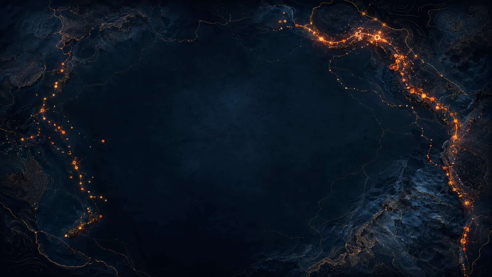
A volcano is a hole through which the planet's interior briefly visits the surface. The Smithsonian Global Volcanism Program tracks roughly 1500 Holocene volcanoes — those that have erupted in the last ten thousand years. Around forty are erupting right now. The map below shows them all. Each red dot pulses because somewhere on Earth, this minute, magma is on the move.
The 958 volcanoes shown come from the Smithsonian Global Volcanism Program's Holocene database (via TidyTuesday 2020). Currently-erupting status is matched against the GVP Weekly Volcanic Activity Report — Smithsonian and USGS update it every Thursday. We bake the data at build time; the map is therefore a snapshot, not a live feed. Each dot is a real volcano at its real coordinates. Click any marker for the GVP detail panel, or open the source page on volcano.si.edu for the live record.
Four readings of one map.
The Ring of Fire.
Roughly 75% of the world's active volcanoes sit on a single horseshoe-shaped line around the Pacific. The reason is plate tectonics: the Pacific oceanic plates subduct beneath the surrounding continental plates, dragging water-rich rock to depths where it melts. That melt rises. The Andes, the Cascades, Kamchatka, Japan, the Philippines, Indonesia, New Zealand — one continuous loop of subduction, one continuous loop of volcanoes.
The other settings.
Subduction zones make most of the noisy volcanoes, but they are not the only kind. Hot spots produce shield volcanoes far from any plate edge — Hawaii, Iceland, Yellowstone, La Réunion. Mid-ocean ridges, where plates pull apart, are by total volume the planet's largest volcanic feature, but most of their output is underwater and quiet. Continental rifts — the East African Rift Valley — make a third class, slow and continental.
The Volcanic Explosivity Index.
Newhall and Self proposed the VEI in 1982: a logarithmic scale from 0 to 8 based on erupted volume, plume height, and qualitative descriptors. A VEI 0 is Hawaiian-style effusion. A VEI 4 (Eyjafjallajökull 2010) grounds European air traffic for weeks. A VEI 5 (Mount St. Helens 1980) flattens forests. VEI 6 (Pinatubo 1991) cools global temperatures by 0.5 °C for two years. VEI 7 (Tambora 1815) caused the Year Without a Summer in 1816. The largest known eruption in human prehistory, Toba ~74 000 BP, is a candidate VEI 8 — possibly responsible for a genetic bottleneck in early humans.
Volcanoes and climate.
Sulphur dioxide injected into the stratosphere by a large eruption forms sulphate aerosols that reflect sunlight back to space. Pinatubo 1991 measurably cooled the planet. Tambora 1815 starved crops across Europe and New England. The 1257 Samalas eruption in Indonesia is linked to medieval famines. The flip side: continuous outgassing from volcanoes was the dominant climate-CO₂ source through most of Earth's history — until we became the bigger source within two centuries.
- Venzke, E. (Editor) (2024) — Volcanoes of the World, v.5.2.4. Smithsonian Institution Global Volcanism Program.
- Smithsonian / USGS — Weekly Volcanic Activity Report. Updated every Thursday.
- Newhall, C. G. & Self, S. (1982) — The Volcanic Explosivity Index (VEI): An estimate of explosive magnitude for historical volcanism. J. Geophys. Res. 87.
- Robock, A. (2000) — Volcanic eruptions and climate. Reviews of Geophysics 38.
- Self, S. et al. (2004) — Magma volume, volatile emissions, and stratospheric aerosols from the 1815 eruption of Tambora. Geophys. Res. Lett. 31.
- Rampino, M. R. & Self, S. (1993) — Climate-volcanism feedback and the Toba eruption. Quaternary Research 40.
- USGS Volcano Hazards Program.
- TidyTuesday Volcano Eruptions dataset (2020-05-12) — community-mirrored Smithsonian GVP snapshot.